If you need a complete Guide to the place, check the Mechuka Travel Guide.
“The car to Along (Aalo) left at 5:30 am. The next one will leave at 2 PM. It will be better if you leave tomorrow morning”, told the guy at the booking counter at Pasighat.
It was only 6 am, quite early for my own standards! I’d reached Pasighat after an unusually punctual ride on the Guwahati Murkongselek Passenger, which reached even before time. Also the short ride from Murkongselek Railway Station to Pasighat on a shared car was pretty smooth owing to good roads. I thought I’d saved a day by reaching early and can make it to Along before the end of the day. But now, I was looking at spending almost 8 hours meandering around Pasighat carrying my backpack. I was also pretty tired because I had been on two different trains for more than three days, coming all the way from Delhi. I could have carried on if I’d managed the transportation immediately. But I lost my momentum once I learnt of the situation. I decided to book it for the next morning and checked into a hotel to relax a bit. This also set the tone of the rest of the trip, one of delightful uncertainties owing to sheer dearth of public transport options in this region.
Anyway, this was my intention to begin with. As a budget traveller, I always look for the cheapest mode of travel and accommodation. Due to its remoteness, I did not find too many information about the reaching Mechuka on public transport. So, the next day I started pretty early at 5:30 am. Apart from a few moments of exhilaration on sighting the turquoise green river Siang, the trip was mostly simple and eventless. The road was severely bumpy at places and smooth at some other stretches. I reached Along by 10.30 am and the same story was repeated here too. Mechuka bound cars leave at only one time, around 5.30 am every morning. There is no other option. So, I checked into another hotel for the day.
The next morning I geared up for the marathon ride to Mechuka. It was 180 kms from Along and considering the roads, at least 8 hours away. Thankfully, the Tata Sumo (This is the only brand of car that runs in these routes) seemed not to be running in full capacity. So, I got a comfortable window seat and the road, contrary to my expectations, seemed to be much better than the previous day. The progress was slow but it did not bother me. Most of the stops seemed to be very small settlements with not more than a dozen homes. After four hours, the car stopped at a small roadside eatery and there was a big signboard saying “Welcome to Mechuka” although it was still 89 kms away.
Nevertheless, this gateway also marked a gradual change in the landscape. Till that point, I was wondering whether the scenery would change at all. Not that I had anything against the usual landscape that I am used to in Assam and the lower regions of Arunachal. But Mechuka was closer to the Chinese border, at a higher altitude. So, I was expecting alpine meadows, something like Chitkul rather than the dense rainforests I’d already experienced in Namdapha.
My spirits rose as the car stopped in front of the slender but pretty steep waterfall called Siko Dido. The driver was thoughtful enough to allow a couple of minutes, so that everyone could savour the view. After this point, the usual bamboos and plantains started disappearing. Some coniferous trees appeared along with some flowering shrubs that were too exotic for me to recognize. Finally, I was in the zone I wanted to be.
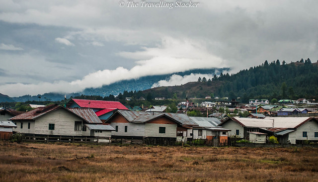
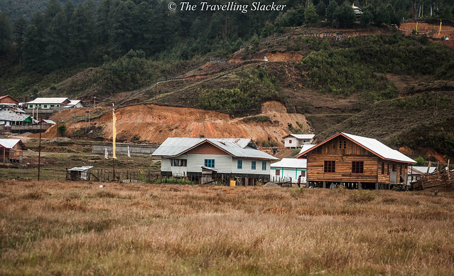
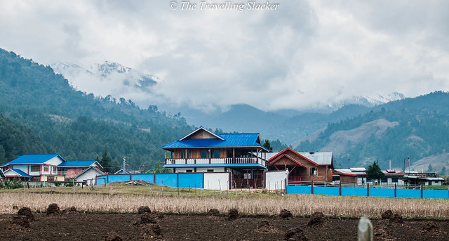
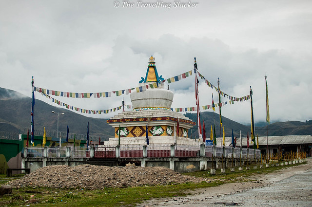
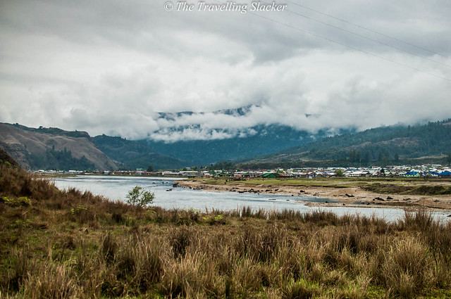
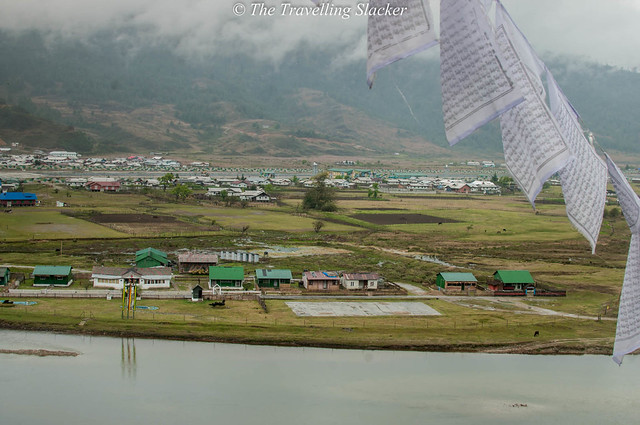
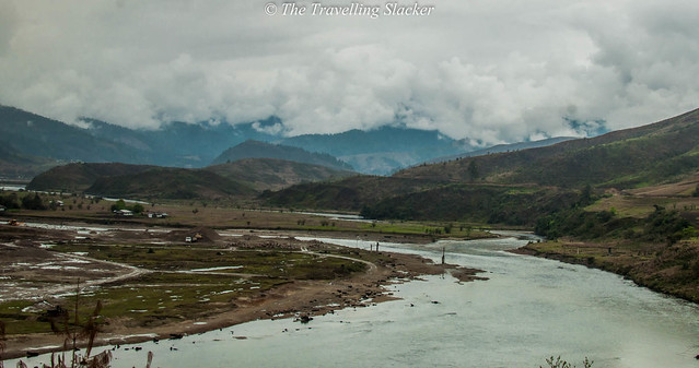
After one final turn the winding roads ended and the car enter a narrow but plain valley. The fabled River Siyom looked serene and welcoming. There were snow capped hills of Tibet in the horizon but the nearer hillocks were greener and had a smooth, olive green, windswept texture devoid of too many big trees. The density of scattered houses increased as the car moved on and finally entered the main square called Gandhi Market (most probably a recent nomenclature). There was a large stupa in one corner and the open area next to it has now been barricaded with high walls as the Indian Air Force is building a small airport here.
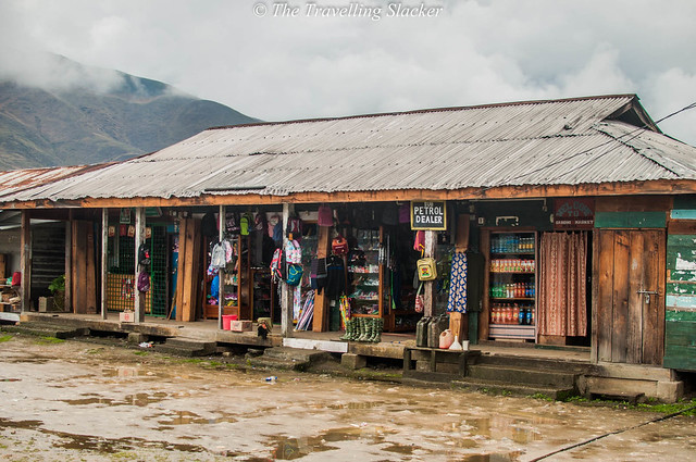
I walked around for a while, noted several small home stays, and finally checked into one called Almost Heritage as it was painted in cheerful blue. It was around 2.30 pm and the lunch time was already over. But they offered me a plate of maggi and tea. Satisfied, I ventured out to explore the market. It was actually much bigger and crowded than I’d expected. There were several local restaurants, grocery shops and in case anyone is wondering, wine shops too. There were shops selling colourful jackets, woollens and shoes, the types you’d find in McLeodganj or Majnu ka Tila. There is something similar about all the places closely related to Tibetan culture. The same shops were also selling petrol and diesel in jerry cans as there were no petrol pumps out there.
So, this brings me to Tibet! Yes, the people out here had a closer link to Tibet. I did notice a few Donyi Polo flags in a couple of households but the dominant community here are the Membas who follow Tibetan Buddhism and framed photographs of Dalai Lama adorn every home and every shop. In fact their trading routes across the border were only closed after the 1962 war due to security reasons. On other hand, it had minimal links with the mainland India till 2007 when finally this motorable road was completed. Till then, they had to trek for days to reach any of the bigger towns. However, the place seems to be expanding now and the value of tourism has been realized. I noticed that several homestays, just normal homes turned into lodges, have cropped up all around in order to cash in on the tourist influx. However, it was the fag end of the season and I did not find another stranger apart from myself.
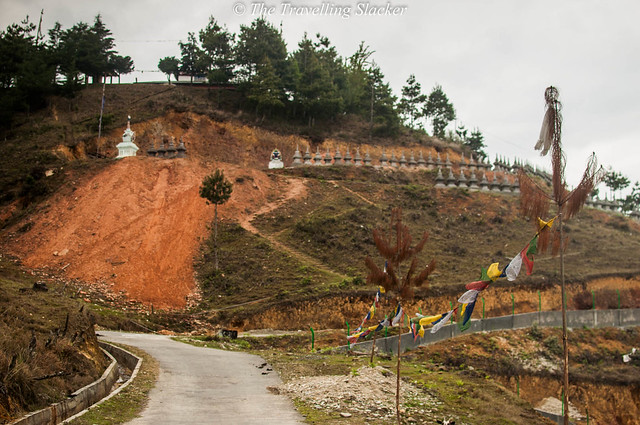
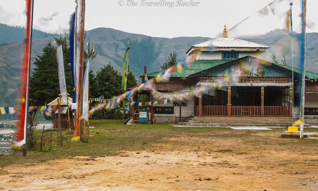
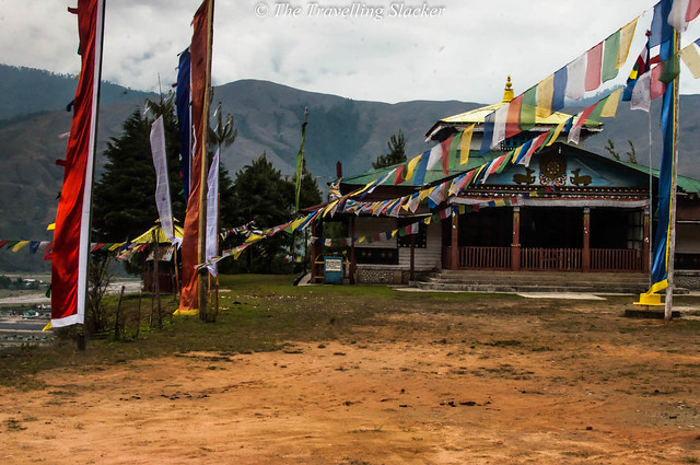
I wanted to get to the river bank but it was about to get dark. So, I decided to take a short walk to the small hillock with the monastery. The monastery is just like any other Tibetan monastery adorned with prayer flags although I guess my timing was not right as there was no one out there. I did get a clearer view of the town from the top and made mental plans for things to do the next morning. That night, it rained heavily!
The next morning I started as soon as possible, hoping to cross the river and climb higher up the hills, possibly to have a look at the higher peaks the valleys lying beyond. Some local youngsters, fashionably dressed and comfortably conversant in Hindi, called me and had a little chat while offering a cup of milk they were drinking. One girl wondered what I was doing there as they would find a big city much more exciting. I told her that one gets attracted to places one does not belong to. Some sort of epiphany hit both of us and I moved on.
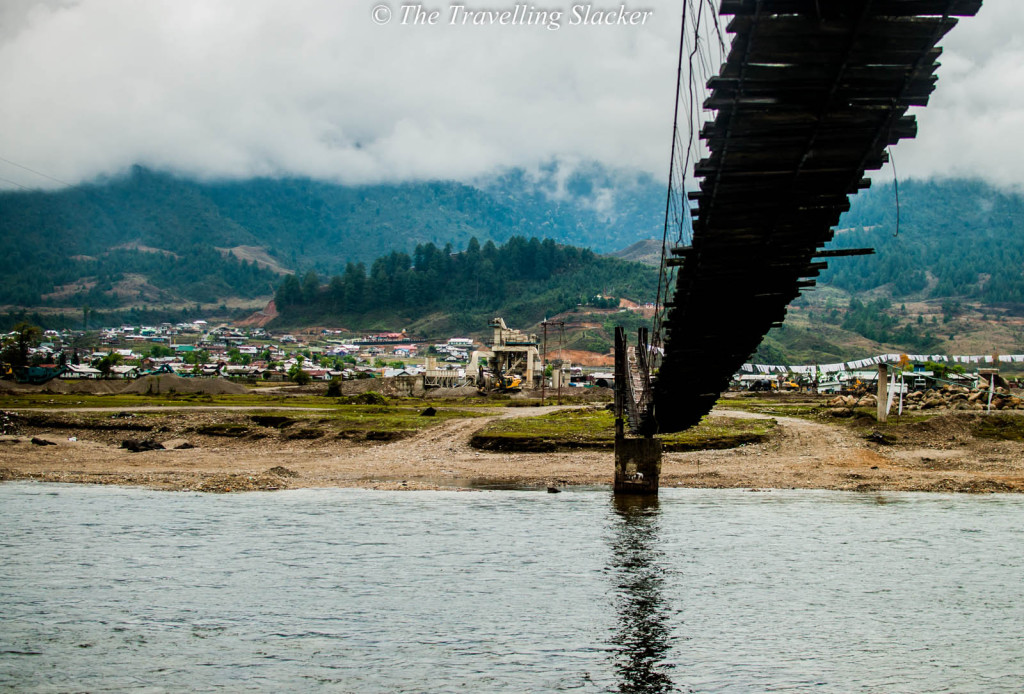
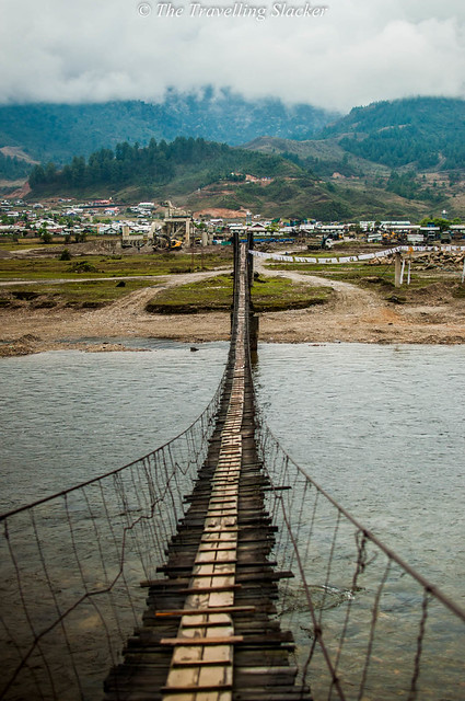
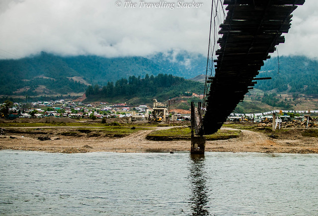
My primary target was to reach the river bank near the hanging bridge. I had to cross the army base in order to reach that point. The army men were busy with their drills and testing their weapons. But generally they do not interfere with civilians passing by the camp. I walked past them and reached the bridge. The river that looked calm and welcoming the day before was looking comparatively muscular from close range. Probably the rains had something to do with it too. I spent some time appreciating the river and then started crossing the bridge. I did not think it would be that hard but it started shaking as I reached the midpoint. I clutched the ropes on both sides with my hands and proceeded at a snail’s pace to finally reach the other end.
The first objective was achieved but the rain was back by that time. I passed the few scattered houses on the slopes and found a path that led to the top of the hill. However, I had to slow down as the rain got heavier and the trek was already slippery due to the rains of the previous night. I tried for half an hour, took time to click photographs from various vantage points but eventually gave up on the idea of reaching the top because at that rate, I was not going to reach before the evening.
I came back to the town, spending some more time by the side of Siyom on my way back. I decided to rest for a while in my room and try to do something else in the afternoon. But it started pouring so heavily that I could do nothing else but to enjoy a good siesta. It was dark when I woke up. It was still raining and I had not booked my cab for the return! I rushed to the market, braving the rain, and booked the last remaining seat of the last remaining car!
The next morning, there was a mild hint of sunshine although the landscape was under heavy mist. I left reluctantly. I just needed to have an hour of sunshine to get the pictures I wanted but my plan was not as good as it should have been. The return journey was a similar affair requiring two more halts and a train ride to reach Guwahati. But it took much more time to come out of the hills as incessant rainfall had softened up the road at many places.
So, what exactly did I learn from this adventure? Well, three things,
• If you want to visit Mechuka, get it done between October to March. Most of the people will advise you to avoid the monsoons anyway but in the NE, the rains start in April itself.
• Accommodation is less of an issue, nor is the food. You will get most of the basic things in the market. Your bigger challenge is transport. The cars to and from Mechula leave only at one time in the morning.
• If you take your own vehicle, be careful about the fuel. There are no petrol pumps after Along. As far as I know, the fuel sold in open at the Mehcuka market comes at a premium.
So, the trip ends here. I considered it a preliminary expedition for myself because I will surely be back with better resources and at a better time. The regions have some of the least explored treks to offer. So, eventually, is Mechuka as distant and as they say?
Well, I thought the distance is mostly psychological, due to lack of information, and to some extent, due to lack of infrastructure. Otherwise, it is only 280 KMs from the last stop on the plains. Far greater distances are traversed by travellers elsewhere in India to get a glimpse of Tibet. Nevertheless, roads are surely being developed in the region, as I could see constructions going on at various points. The desolation will end at some point but will it take away the charm too?

So beautiful. Awesome pics.
I love your blog for its offbeat destinations and no nonsense, information packed writing. Mechuka has been on my mind since long. I even thought it is not possible to go here without a guide or package. But your blog makes it within my reach without compromising on my style, which is similar to yours (when I am not going on official trips, that is).
Some great information here. Hoping to make here someday!.
Vert detailed and useful write up.
Useful with stunning pics.
Wonderful and to the point writing Jitaditya bhai! Loved it.
@abhinav bhai, ajao fir!
Simply awesome. No nonsense full of information for actual travellers. Loved it!!
Thanks Krishnendu
thats a great piece of writing you got there ..good job..loved reading it
Thanks a lot!
I’ve never heard of Mechuka but I’d love to visit the Himalayas and this place sounds fascinating. I’d be very interested to find out more about Tibetan culture. That bridge is like something out of Indiana Jones – I’m not surprised your hands started to shake halfway across!
What an interesting, off the beaten path destination. It sounds a little difficult to get there, but I suppose that’s all part of the adventure! That bridge does look a bit freaky, but I would probably give it a go!
There are so many beautiful and unknown villages throughout India, this was such an interesting read! I would love to visit this area in the future as experiencing this first hand must be a highlight of anyones travels!
Thanks for sharing this post!
What an incredible adventure to head out to Mechuka.My favorite part of the journey was the walk across the army base only to be met by the river and shaky bridge. You describe it peacefully…but it seems like it could be such a dramatic scene! 😀
The mountains in the backdrop, the bridge and the small shops are simply beautiful. The place is right out of a postcard. I would love to visit here. Looks like easily approachable from Guwahati , right?
Sounds like quite the adventure to get to your destination. Nice piece and pictures to make us feel like we were a part of your journey.
That bridge looks amazing…and terrifying! Like something out of Indiana Jones!! Great write up, very informative!
The travelling slacker is not so slack with this post and adventure. Very descriptive read, well told and I enjoyed the yarn about your adventure to Mechuka. Great photos too, the scenery looked fantastic.
What a journey! What a beautiful part of the country. That bridge looks fun and scary.
Well it was difficult to realize which part of the world you were talking about but once i did, i could understand the landscapes and beauty better. Its amazing how you discovered such remote places and how you journey them.
That bridge looks sketchy as hell. You had quite the adventure. Thanks for sharing.
Mechuka seems charming and off the beaten track. A place where you can revel in the spirit of travel. I like the way you write personalized accounts of your trips which are generally to offbeat destinations. This has more heart in it. We do not find many of those kind around.
wow, it looks you had such a great adventure 😀 . Actually I didn’t know the places you mentioned before, they must be really remotes…Anyway I Love the pictures you used, in particular the wood bridge one, really amazing. Great post
This was an awesome read. Your photography is pretty cool. What camera do you use? Looks like you had quite an adventure. That bridge looks sketchy to me though, haha.
Thanks… use Nikon D5000 with 35mm lens
Considering this sounds quite remote and a bit challenging to get to, how difficult do you think it would be managing the region for a foreigner who doesnt speak the language?
Hey its not that hard… In India you can always fnd someone who speaks English even in the remotest places… I did meet a couple from UK on my way…
I love visiting places like Mechuka, where the time seems to go very slow. The location of the town is so beautiful, surrounded by mountains, and all those Tibetan flags make me think that it’s a very peaceful place also. Shame it is so hard to reach it by public transport.
WOOWOW, this makes me want to go to Mechuka. Going to ask you for all kinds of tips when I go. 🙂
Really loved your article bro and as always awesome pictures. I have also sent an article for Discover India’s North East edition. What all food did you try there?
I really like how you write. You wrote your articles, this one included, with soul and heart in it. Thanks for bringing us in off the beaten paths. I haven’t been to India and Tibet, so thank you for the photos. Continue writing this way.
Lovely pics. I’ve never heard about Mechuka, so it was great to discover a new destination (vicariously, but still!). I’ve heard a lot about safety issues in the region – did you face any such issues in Guwahati or en route Mechuka?
Pingback: Mechuka DIY Travel Guide | The Travelling Slacker
HI Jitaditya, great post! wanted to know if you really need a private taxi to move around this place or can it be done on foot?
You only reach there on a car…
You must hike around the hills… there are no cabs for local sightseeing…
Wow… I want to visit this place soon! Arunachal was on my list this rain, but since I was sick – decided to go for Darjeeling… Next for sure! Lovely writing and photographs… But I love the pictures more 😉
You did the right thing. Come back in the winter. You should not take on Arunachal rains.
Pingback: Manipur: Chronicles of a Washout Foretold | The Travelling Slacker
am glad i ran into your blog. keep writing.
Great…Well written.
Want to visit Mechuka one day…
Must go to Mechuka and keep following your blog